


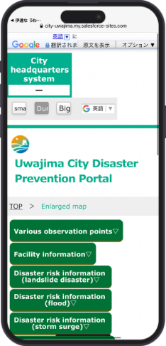
What is“Date na Uwajima Hotto Navi”?
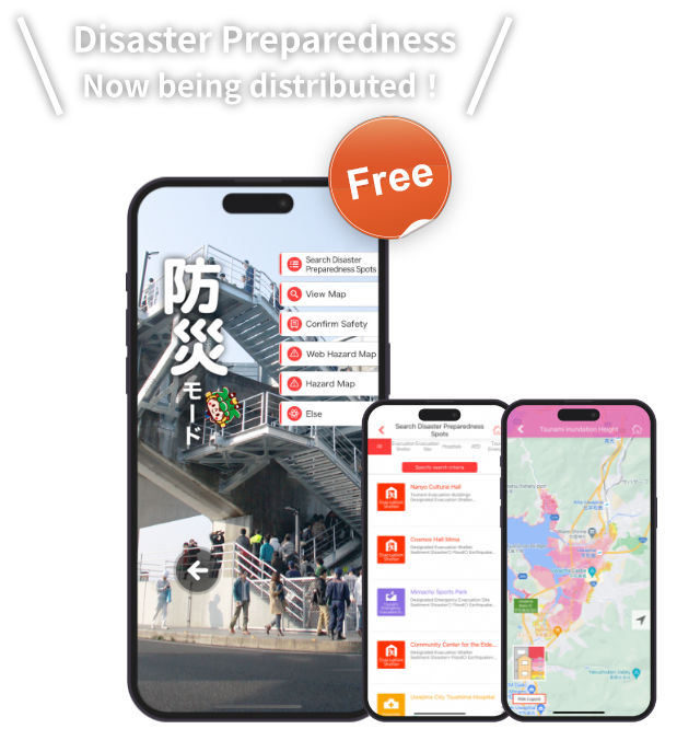
"Date na Uwajima Hotto Navi" is an application for smart phones (multi-functional cell phones) that allows users to obtain disaster prevention information for Uwajima when needed.
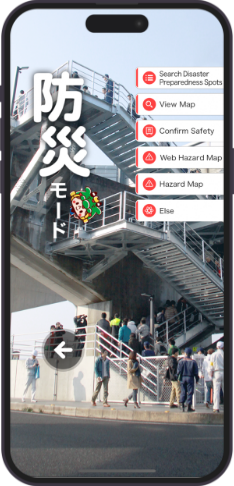
It is equipped with a "disaster preparedness" function to support safe evacuation in the event of natural disasters such as a 'Nankai Trough' earthquake.
You can find evacuation sites and hospitals, identify dangerous areas, and prepare for any disaster that may occur.
- * Please note that this application is only compatible with smartphones (multi-functional cell phones) running Android and iOS.
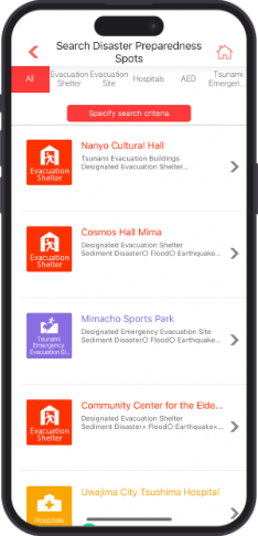
Search Disaster Preparedness Spots
You can switch tabs and search for disaster prevention spots in Uwajima City, divided into the following genres: "Evacuation Shelters," "Evacuation Sites," "Hospitals," "AED," "Tsunami Emergency Evacuation Sites," and "Tsunami Evacuation Buildings."
A navigation function to direct users to disaster prevention spots is also available.
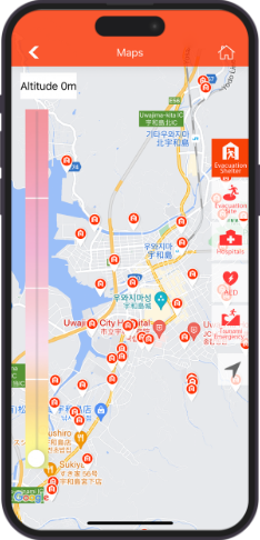
View Map
Disaster prevention spots in Uwajima City can be selected and displayed on the map, categorized into the following genres: "Evacuation Shelters," "Evacuation Sites," "Hospitals," "AED," and "Tsunami Emergency Evacuation Sites.
Slide the elevation bar to narrow down the list of facilities located above the assumed elevation. Tap the "Current Location" button to display the elevation of your current location.
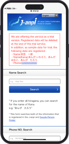
Confirmation of Safety
In addition to the safety information on the Disaster Message Boards provided by telecommunications carriers, the site will connect to the "J-anpi Safety Information Collective Search" site, a joint site where safety information collected by various companies and organizations can also be checked together.
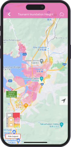
Web Hazard Map
You can check on a map the areas that are expected to be damaged by disasters such as typhoons and heavy rains by specifying multiple conditions and dividing them by disaster information.
Hazard Map
"Tsunami Inundation Depth", "Flood Inundation Area Planned Rainfall", "Flood Inundation Area Assumed Maximum Scale Rainfall", "Landslide Hazard Area", and "Landslide Hazard Warning Area/Special Warning Area" are divided into maps of areas that are expected to be affected by disasters such as typhoons, heavy rain and tsunami. The map can be zoomed in and out, allowing you to smoothly obtain information on your current location.
*The landslide hazard map is current as of February 2021. Please note that they may differ from the latest information.